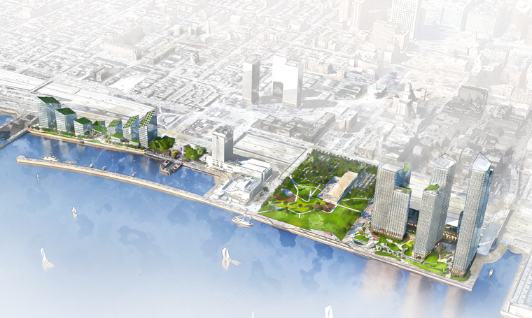
The Durst Organization’s Penn’s Landing redevelopment plan, revealed last month as the winner of a major competition, is set to bring dramatic change to the Delaware River waterfront with a total of 3.6 million square feet of mixed-use space. The project is also slated to bring an 11.5-acre park that will connect the I-95 Park to Penn’s Landing, with green space built atop new platforms over the Delaware Expressway. Two large tracts will be redeveloped to yield a total of 15 buildings, with the southern portion featuring towers rising around 300 feet and the norther end with skyscrapers standing as high as 700 feet. The project will bring 1,834 residential units to the eastern edge of Center City.
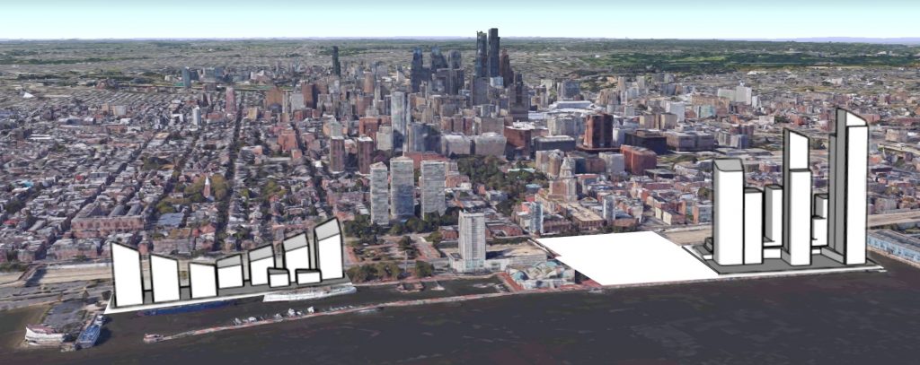
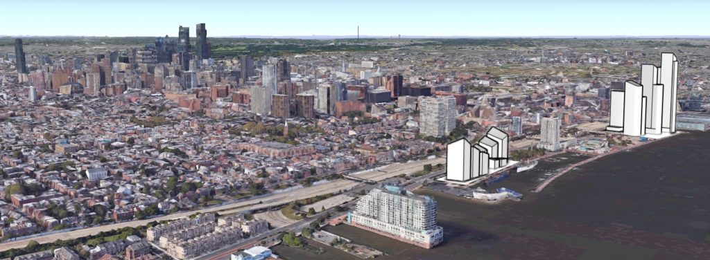
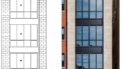
Below, Philadelphia YIMBY’s exclusive set of concept massings display the impact the development will have on the skyline about eight years from now, when the project anticipates completion.
Penn’s Landing Redevelopment looking west. Original image via Google Earth, edit by Thomas Koloski
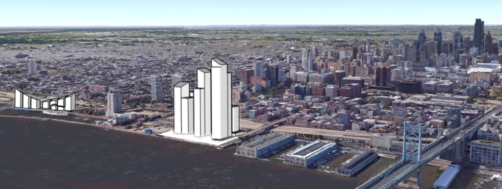
Penn’s Landing Redevelopment looking southwest. Original image via Google Earth, edit by Thomas Koloski
The redevelopment will transform the Philadelphia skyline with its massive scope and its prominent location. When viewed from the Camden Waterfront, the development will block certain views of the core Center City skyline. The new towers will pop into view from many vantage points in New Jersey, mainly at locations to the southeast of Center City.
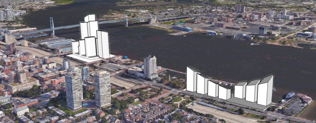
Penn’s Landing Redevelopment looking northwest. Original image via Google Earth, edit by Thomas Koloski
When driving on the Benjamin Franklin Bridge, views of the core Center City skyline will be blocked by the riverfront cluster of towers just after passing the toll booths, visible from behind the metal cables that support the suspension bridge. The proposed towers will stand out from the area due to the low skyline of Old City, where building height is limited in many areas, punctuated by a few lonely towers.
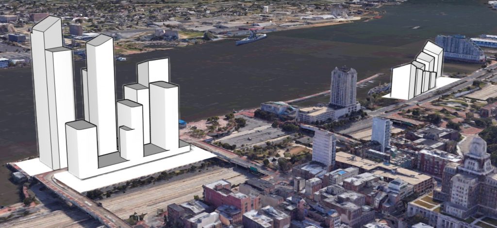
Penn’s Landing Redevelopment looking northeast. Original image via Google Earth, edit by Thomas Koloski
Penn’s Landing Redevelopment looking southeast. Original image via Google Earth, edit by Thomas Koloski

Penn’s Landing Redevelopment viewed from the Delaware River. Model by Thomas Koloski

Penn’s Landing Redevelopment (right) and the Philadelphia skyline. Model by Thomas Koloski
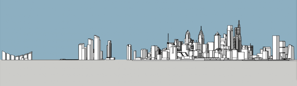
Penn’s Landing Redevelopment (left) and the Philadelphia skyline. Model by Thomas Koloski
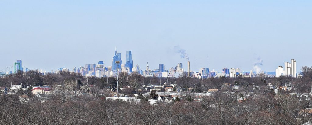
Penn’s Landing Redevelopment (right) and the Philadelphia skyline. Model and photo by Thomas Koloski
Subscribe to YIMBY’s daily e-mail
![]()
Follow YIMBYgram for real-time photo updates
Like YIMBY on Facebook
Follow YIMBY’s Twitter for the latest in YIMBYnews


Very nice… Looks like a great spot to dock SS United States as a hotel, of course I’d still rather she come to NYC’s Pier 56/55 area.
I’ll get excited when I see actual proposals from developers. ??
It is an attractive concept, but what will be the impact on traffic on Columbus Boulevard and the feeder roads to center city (Market, Walnut, Spruce and Lombard Streets)?
In eight years we will be extremely lucky to have anything built on these 2 sites. Remember all Durst has “won” is the right to further talks. A very strange system, as if talks can’t be held with more then one party.