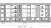
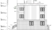
Permits have been issued for the construction of a three-story single-family rowhouse at 3618 Sears Street in Forgotten Bottom, South Philadelphia. The new structure will fill a vacant lot on the south side of the block between South 36th Street and Schuylkill Avenue. Designed by Vincent Mancini of Landmark Architectural Design, the building will span 1,887 square feet and will feature a basement and a roof deck. Permits list Air Tight Heating and Cooling as the contractor.
Construction costs are specified at $300,000, of which $15,000 is allocated toward electrical work, $12,500 for mechanical work, $21,000 for plumbing work, and $30,000 for excavation work.
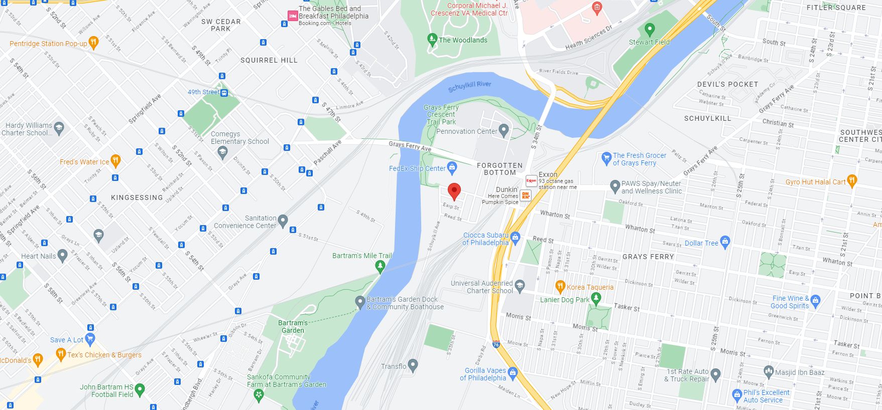
3618 Sears Street. Site map. Credit: Google Maps
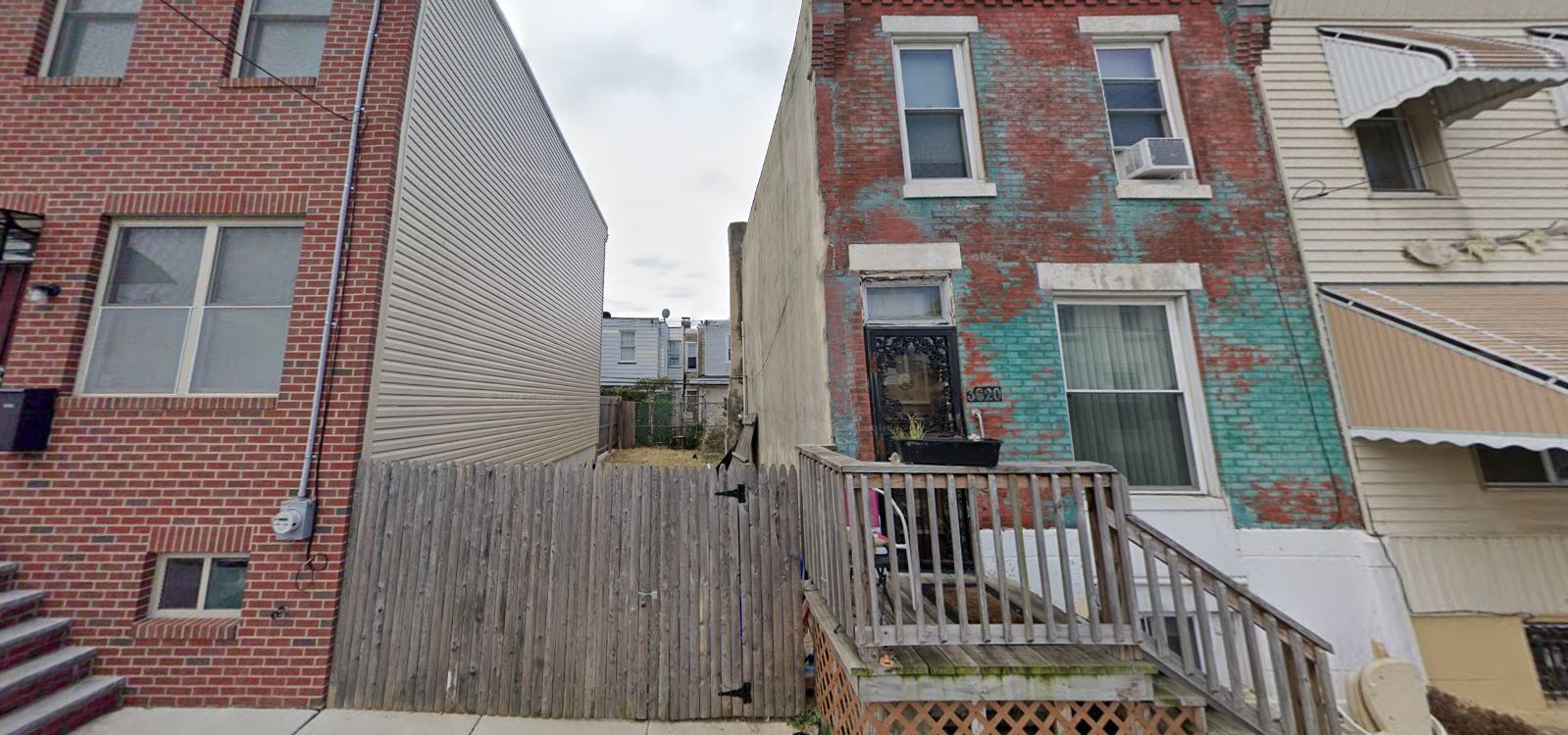
3618 Sears Street. Site conditions prior to redevelopment. Looking south. October 2019. Credit: Google Maps
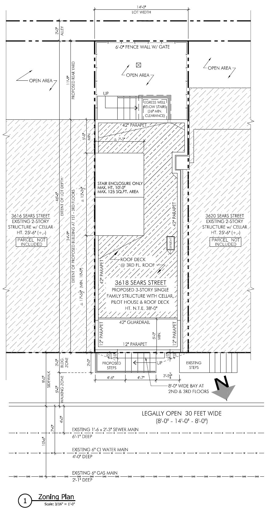
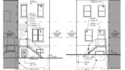
3618 Sears Street. Site plan. Credit: Landmark Architectural Design LLC
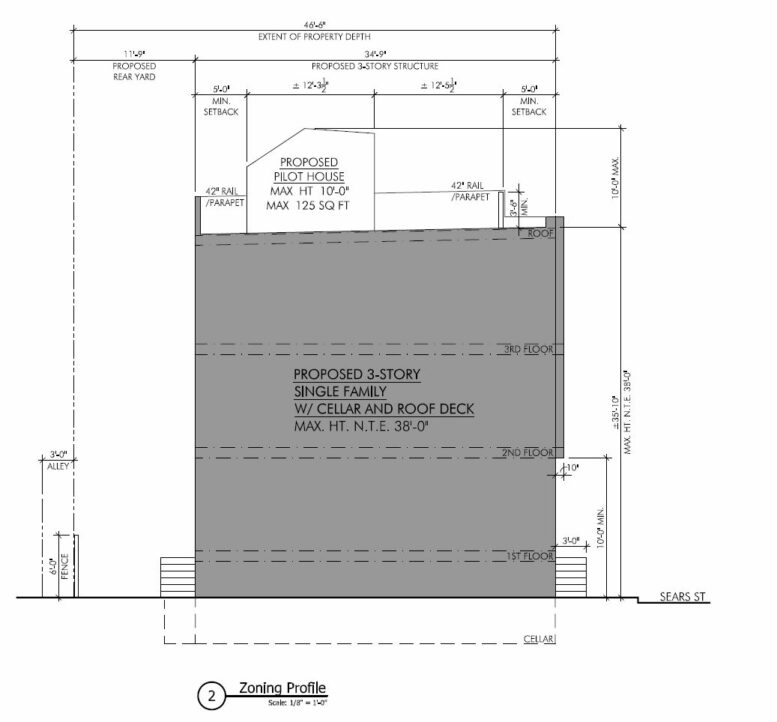
The structure will measure 14 feet wide and 35 feet deep, backed by a 12-foot-deep rear yard. The building will rise 36 feet to the top of the main roof, 39 feet to the top of the parapet, and around 46 feet to the top of the pilot house. Rising a full floor above every other building on the block, the roof deck will open onto panoramic views of University City and Center City skylines, both situated in relative proximity within roughly one and two miles away, respectively.
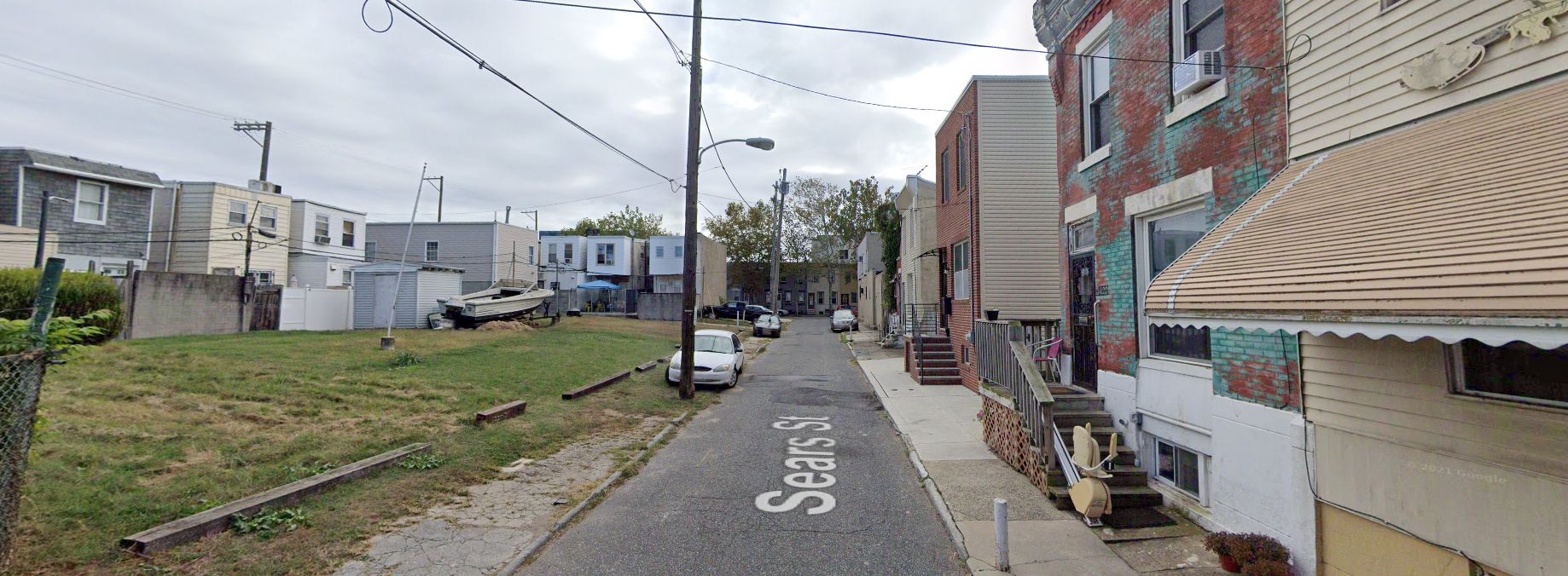
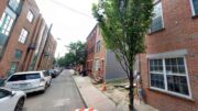
Sears Street, with 3618 Sears Street on the right. Site conditions prior to redevelopment. Looking east. October 2019. Credit: Google Maps
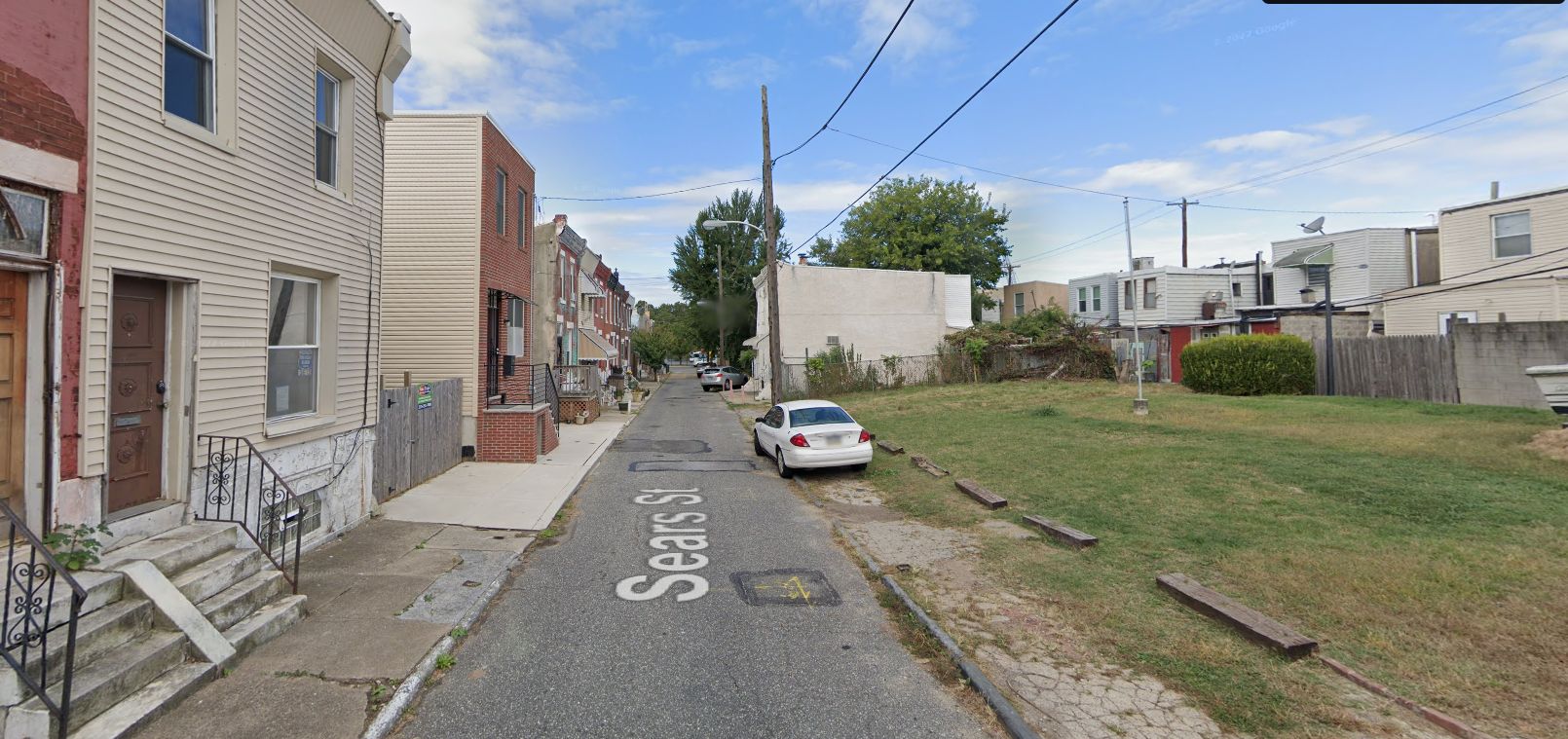
Sears Street, with 3618 Sears Street on the left. Site conditions prior to redevelopment. Looking west. October 2019. Credit: Google Maps
Forgotten Bottom is a compact and rather isolated neighborhood situated at the western end of Grays Ferry, sitting on a peninsula formed by a bend of the Schuylkill River and separated from the rest of South Philly by a train trestle and the elevated Interstate 76 aka the Schuylkill Expressway. The neighborhood consists of around seven compact rowhouse blocks surrounded by commercial and industrial facilities.
True to its name, the neighborhood often seems to be rarely visited or even thought of by most of the city’s residents, and generally sits off developers’ radar. However, the development boom currently sweeping the northern portion of South Philly has reached even this neck of the woods, with a number of new residential projects rising on the seven blocks in recent years.
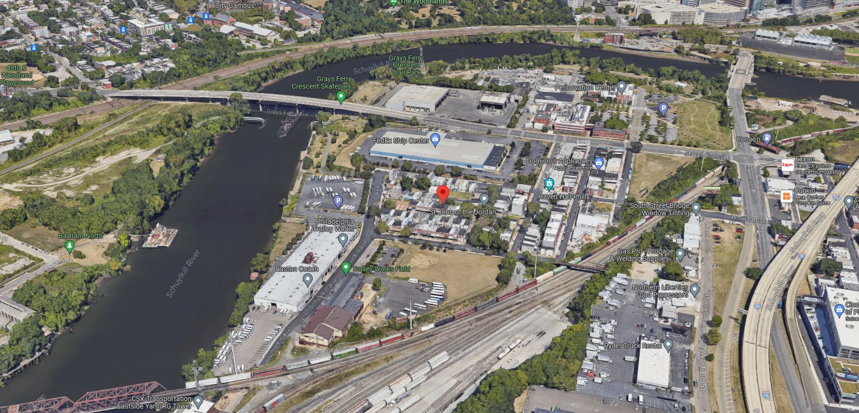
3618 Sears Street and Forgotten Bottom. Aerial view prior to redevelopment. Looking north. Credit: Google Maps
Although seemingly remote, Forgotten Bottom is situated conveniently close to several notable destinations. Grays Ferry Crescent Trail Park runs along the Schuylkill River waterfront at the neighborhood’s northern and western edge. The University City Medical District sits around half a mile to the northeast on the opposite side of the river, directly accessible via the University Avenue Bridge at South 34th Street.
To the west, the Grays Ferry Avenue Bridge connects to Southwest Philadelphia, where the nearest destinations include the 48th and Woodland Playground and the waterfront Bartram’s Garden, as well as route 11 and 36 trolleys. Stinger Park sits within a ten-minute walk to the southeast of 3618 Sears Street. Route 12 and 64 buses run along Grays Ferry Avenue.
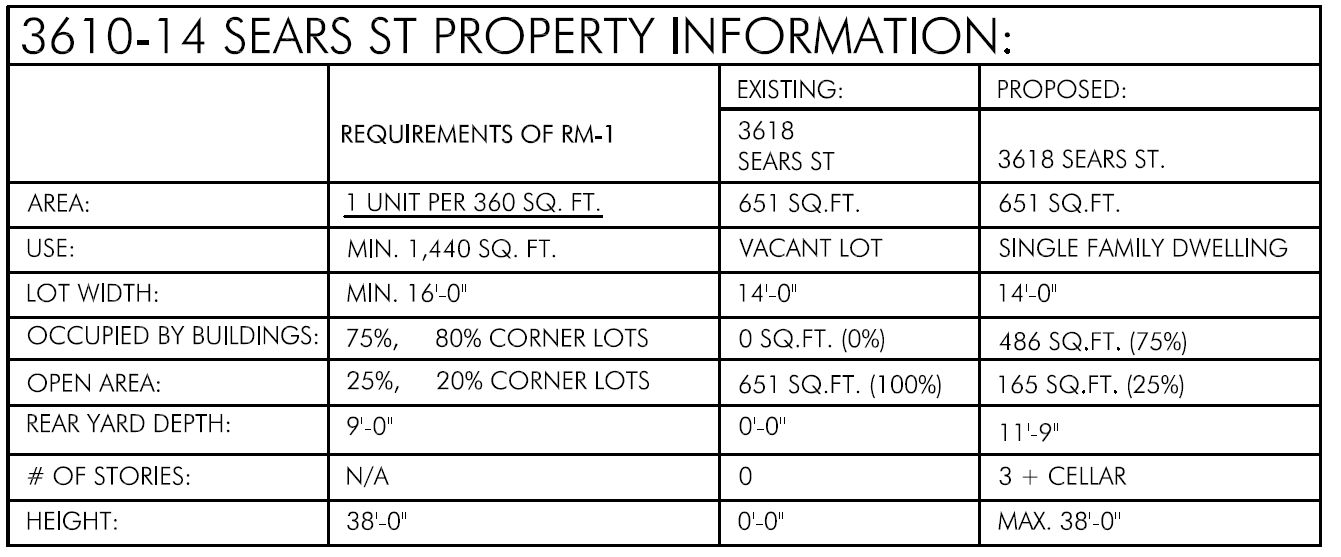
3618 Sears Street. Zoning table. Credit: Landmark Architectural Design LLC
Subscribe to YIMBY’s daily e-mail
![]()
Follow YIMBYgram for real-time photo updates
Like YIMBY on Facebook
Follow YIMBY’s Twitter for the latest in YIMBYnews
Be the first to comment on "Permits Issued for 3618 Sears Street in Forgotten Bottom, South Philadelphia"