The Laurel Rittenhouse Square

The Laurel Rittenhouse Square from Market Street. Photo by Thomas Koloski

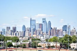
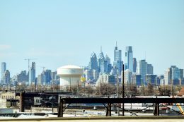
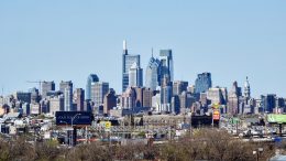
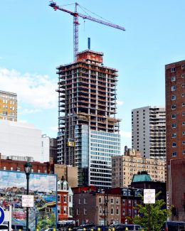
The Laurel Rittenhouse Square Nearing Topping Out in Rittenhouse Square, Center City

In recent weeks, the Laurel Rittenhouse Square has been rising at a steady pace, and is now leaving an imposing presence on the Philadelphia skyline. The tower, located at 1911 Walnut Street in Rittenhouse Square, Center City, is growing to reach a final height of 599 feet and 48 floors. Designed by Solomon Cordwell Buenz and developed by the Southern Land Company, the skyscraper will hold 160 rental apartment units and 85 luxury units.

Read More

Philadelphia skyline from Live! Casino and Hotel garage. Photo by Thomas Koloski

YIMBY Observes The Rising Philadelphia Skyline From The Live! Casino and Hotel In The Sports Complex District, South Philadelphia

Today YIMBY looks at the skyline from a brand new viewpoint at the Live! Casino and Hotel, which has a fantastic view of the Center City towers. The photographs in this publication are taken from the parking garage, located to the south of the hotel portion of the entire project along with being to the south to the skyline. The hotel is located two blocks to the north of Citizens Bank Park, in the Sports Complex District in South Philadelphia.

Read More

Philadelphia skyline from I-95. Photo by Thomas Koloski

YIMBY Observes the Rising Philadelphia Skyline from the Interstate 95

Today Philly YIMBY observes the city from the Interstate 95, where the skyline opens into a dramatic view. The highway is one of the longest in the country as it starts in Florida and travels north along the East Coast going through 15 states for 1,908 miles to the Canada border in Maine. But in Philadelphia, the I-95 runs along the Delaware River past the Girard Point Bridge, the sports complex, and the Navy Yard. The highway then turns north and runs under the Walt Whitman Bridge, past the decommissioned SS United States, which once held the Blue Riband as the fastest transatlantic ocean liner. The highway then travels past Penn’s Landing and under the Benjamin Franklin Bridge, where it turns to the northeast to head towards Trenton and New York City.

Read More

Philadelphia skyline from I-676. Photo by Thomas Koloski

YIMBY Observes the Rising Philadelphia Skyline from the I-676

Recently, Philly YIMBY has covered the rising Philadelphia skyline from the Interstate 95 South and the Walt Whitman Bridge. Today we look at the skyline from the outlook at the Interstate 676 in Camden, New Jersey, which reveal a unique view of Philadelphia’s skyscrapers. The I-676 circles around the city as the Vine Street Expressway cuts through the north side of Center City, then heads south toward the Sports Complex and turns back to the Walt Whitman Bridge. The I-676 then heads south and becomes Route 42, while heading north on the highway takes one toward Camden and onto the Benjamin Franklin Bridge, which leads back to the Vine Street Expressway and further in University City and beyond.

Read More

Philadelphia skyline from the Walt Whitman Bridge. Photo by Thomas Koloski

YIMBY Observes the Rising Philadelphia Skyline from the Walt Whitman Bridge

The Walt Whitman Bridge presents an excellent vantage point for a showcase of the major projects that are rising in the Philadelphia skyline. Today Philadelphia YIMBY shares photos of the city taken from the suspension bridge, which is one of the largest structures that spans the Delaware River, with towers that stand 378 feet tall. The west end of the bridge is situated just to the north of the Port of Philadelphia, from where it heads east to Gloucester City, New Jersey on the other side of the river and provides access to Camden, Trenton, Atlantic City, and beyond. The route to New Jersey features a view of billboards that annoyingly block the skyline from the Philadelphia side, the Southwark Generating Station and its four white chimneys. However, when heading west towards the city, the bridge offers panoramic views of the skyline.

Read More

Fetching more...